
- …
- Yak
- Quests
- Sierra Peaks Section
- Mount Agassiz
13,895 ft · Sierra Nevada, California
Mount Agassiz
Mount Agassiz is a 13,895 ft peak in the Sierra Nevada, California. The standard route is the West Slope: 14 mi, 4,285 ft of gain, Class 2.
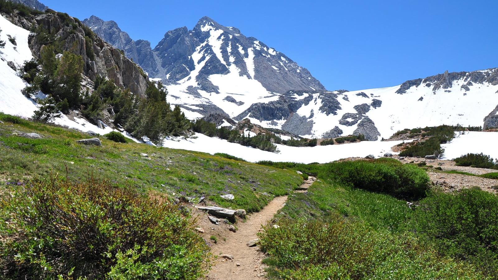
Photo: The Fun Chronicles
Mount Agassiz at a glance
- Elevation13,895 ft4,235 m
- RouteWest SlopeClass 2
- Distance14 mi4,285 ft gain
- Time9 – 11 hrsHard effort
- SeasonJul – Sep
- RangeSierra NevadaCalifornia
Climbing the West Slope
From Bishop, drive Highway 168 and South Lake Road to the South Lake trailhead and hike the Bishop Pass Trail past Long, Saddlerock and Bishop Lakes to Bishop Pass. Leave the trail heading southeast, pass a small tarn, and climb the rightmost gully on the west face. The West Slope is class 2 on talus and slabs, with an optional class 3 step depending on the line; take the left branch where the gully splits and finish along the summit ridge. The descent is long, loose talus. Start before dawn, since the pass and summit ridge draw afternoon storms.
Gear and hazards
What to bring
 Backpack (35–55 L)
 Hiking Boots
 Water
 Offline Maps
 Headlamp
 Satellite Communicator
 Whistle
 Sunglasses
 Sunscreen
 Sun Hat
 Midlayer
 Insulated Jacket
 Hardshell Jacket
 Warm Hat
 Buff
 Midweight Gloves
 Trekking Poles
 GPS Device
 Power Bank
 Water Filter
 First-Aid Kit
 Emergency Bivy
What to watch for
- Loose rock
- High altitude
- Storms
- Rapid weather shifts
Quests with Mount Agassiz
 Sierra Peaks Section
Peaks near Mount Agassiz


Frequently asked questions
How tall is Mount Agassiz?
Mount Agassiz is 13,895 feet (4,235 m) tall. It is in the Sierra Nevada, California.
How hard is it to hike Mount Agassiz?
The West Slope is Class 2, which means off-trail hiking with some use of your hands for balance. Yak rates the overall effort hard: 14 miles with 4,285 feet of elevation gain.
How long does it take to hike Mount Agassiz?
Most people take 9 – 11 hours round trip on the West Slope, covering 14 miles with 4,285 feet of elevation gain. That is a long day, so start before dawn and set a turnaround time.
Can a beginner hike Mount Agassiz?
The West Slope needs no climbing skills, but it is a hard day: 14 miles with 4,285 feet of elevation gain. Build up on shorter hikes first, start early and carry plenty of water and layers.
Will you get altitude sickness on Mount Agassiz?
You might. Most people feel the altitude above 8,000 feet, and Mount Agassiz reaches 13,895 feet. Spend a night or two at elevation first, drink plenty of water and turn back if a headache, nausea or dizziness gets worse.
What time should you start hiking Mount Agassiz?
Early. Afternoon thunderstorms are common in summer, so aim to be off the summit and the exposed upper mountain by early afternoon. At 9 – 11 hours round trip, many parties start in the dark.
When is the best time to hike Mount Agassiz?
The usual hiking window is July to September. Outside it, expect snow, storms or closed access, and check the summit forecast before you go.
Climb Mount Agassiz with Yak
Plan your route on a topo map, check the summit forecast, then log your climb and see what is left on your list