
- …
- Yak
- Quests
- Sierra Peaks Section
- Mount Dana
13,057 ft · Sierra Nevada, California
Mount Dana
Mount Dana is a 13,057 ft peak in the Sierra Nevada, California. The standard route is the West Slopes from Tioga Pass: 6 mi, 3,765 ft of gain, Class 1.
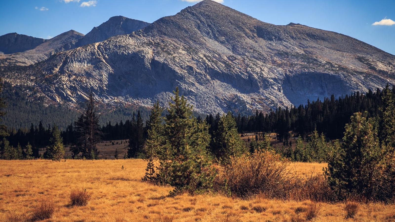
Mount Dana at a glance
- Elevation13,057 ft3,979 m
- RouteWest Slopes from Tioga PassClass 1
- Distance6 mi3,765 ft gain
- Time5 – 7 hrsHard effort
- SeasonJun – Oct
- RangeSierra NevadaCalifornia
Climbing the West Slopes from Tioga Pass
Drive Tioga Road (CA 120) from Lee Vining or Tuolumne Meadows to the Tioga Pass entrance station and park nearby. An unsigned use trail starts behind the station, crosses meadows and climbs steadily through whitebark pine onto open west slopes. Above a plateau the path fades into Class 1 talus and scree that leads straight to the summit. The climb is short but steep at altitude, so pace yourself and watch for headache or nausea. Storms build fast over the crest in summer, so start early. Views reach Mono Lake and the Dana Glacier below.
Gear and hazards
What to bring
 Backpack (25–35 L)
 Hiking Boots
 Water
 Offline Maps
 Headlamp
 Satellite Communicator
 Whistle
 Sunglasses
 Sunscreen
 Sun Hat
 Midlayer
 Insulated Jacket
 Hardshell Jacket
 Warm Hat
 Buff
 Midweight Gloves
 Trekking Poles
 GPS Device
 Power Bank
 Water Filter
 First-Aid Kit
 Emergency Bivy
What to watch for
- High altitude
- Altitude sickness
- Storms
- High winds
Quests with Mount Dana
 Sierra Peaks Section
Frequently asked questions
How tall is Mount Dana?
Mount Dana is 13,057 feet (3,979 m) tall. It is in the Sierra Nevada, California.
How hard is it to hike Mount Dana?
The West Slopes from Tioga Pass is Class 1, which means hiking on a trail. Yak rates the overall effort hard: 6 miles with 3,765 feet of elevation gain.
How long does it take to hike Mount Dana?
Most people take 5 – 7 hours round trip on the West Slopes from Tioga Pass, covering 6 miles with 3,765 feet of elevation gain, so most people do it in a day.
Can a beginner hike Mount Dana?
The West Slopes from Tioga Pass needs no climbing skills, but it is a hard day: 6 miles with 3,765 feet of elevation gain. Build up on shorter hikes first, start early and carry plenty of water and layers.
Will you get altitude sickness on Mount Dana?
You might. Most people feel the altitude above 8,000 feet, and Mount Dana reaches 13,057 feet. Spend a night or two at elevation first, drink plenty of water and turn back if a headache, nausea or dizziness gets worse.
What time should you start hiking Mount Dana?
Early. Afternoon thunderstorms are common in summer, so aim to be off the summit and the exposed upper mountain by early afternoon.
When is the best time to hike Mount Dana?
The usual hiking window is June to October. Outside it, expect snow, storms or closed access, and check the summit forecast before you go.
Climb Mount Dana with Yak
Plan your route on a topo map, check the summit forecast, then log your climb and see what is left on your list