
- …
- Yak
- Quests
- Sierra Peaks Section
- Temple Crag
13,004 ft · Sierra Nevada, California
Temple Crag
Temple Crag is a 13,004 ft peak in the Sierra Nevada, California. The standard route is the Southeast Chute: 11 mi, 5,775 ft of gain, Class 3.
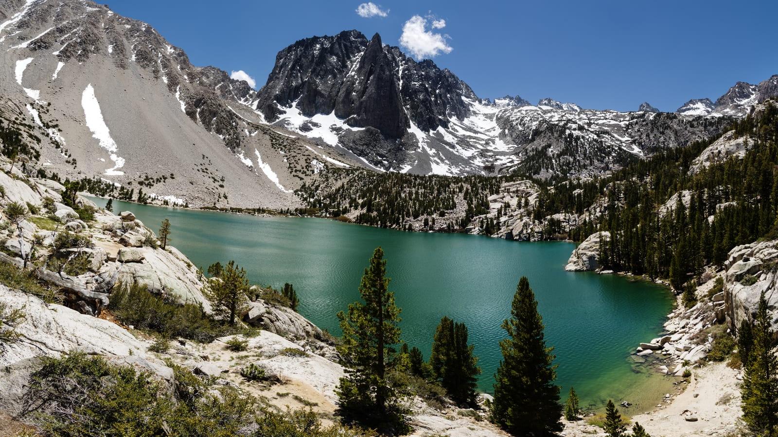
Temple Crag at a glance
- Elevation13,004 ft3,963 m
- RouteSoutheast ChuteClass 3
- Distance11 mi5,775 ft gain
- Time10 – 12 hrsVery Hard effort
- SeasonJul – Sep
- RangeSierra NevadaCalifornia
Climbing the Southeast Chute
From Big Pine on US 395, drive Glacier Lodge Road to the Big Pine Creek trailhead. Take the South Fork Trail to the Willow Lake junction, then follow cairns up the South Fork and the Elinore Lake outlet. Scramble loose scree north to the southeast flank of the peak, west of Contact Pass. The Southeast Chute route climbs ramps into a chute, crosses a talus bowl right of the pinnacles, and finishes with a short, exposed class 3 step. Early season brings hard snow in the chutes, so carry an ice axe. Wear a helmet and start early to beat afternoon storms.
Gear and hazards
What to bring
 Backpack (35–55 L)
 Hiking Boots
 Water
 Offline Maps
 Headlamp
 Satellite Communicator
 Whistle
 Sunglasses
 Sunscreen
 Sun Hat
 Midlayer
 Insulated Jacket
 Hardshell Jacket
 Warm Hat
 Buff
 Midweight Gloves
 Trekking Poles
 GPS Device
 Power Bank
 Water Filter
 First-Aid Kit
 Emergency Bivy
 Helmet
What to watch for
- Loose rock
- Rockfall
- Steep exposure
- Rapid weather shifts
Quests with Temple Crag
 Sierra Peaks Section
Peaks near Temple Crag


Frequently asked questions
How tall is Temple Crag?
Temple Crag is 13,004 feet (3,963 m) tall. It is in the Sierra Nevada, California.
How hard is it to climb Temple Crag?
The Southeast Chute is Class 3, which means scrambling, where you use your hands to climb and a fall could be serious. Yak rates the overall effort very hard: 11 miles with 5,775 feet of elevation gain.
How long does it take to climb Temple Crag?
Most people take 10 – 12 hours round trip on the Southeast Chute, covering 11 miles with 5,775 feet of elevation gain. That is a long day, so start before dawn and set a turnaround time.
Is Temple Crag dangerous to climb?
It has real risks: exposed sections where a fall would be serious, rockfall from loose rock and fast-changing weather. Go with an experienced partner, wear a helmet, test holds before you trust them and turn back if the rock is wet or icy.
Do you need a helmet for Temple Crag?
It is a good idea. Loose rock and rockfall are common on the Southeast Chute, so a helmet is on the gear list.
Will you get altitude sickness on Temple Crag?
You might. Most people feel the altitude above 8,000 feet, and Temple Crag reaches 13,004 feet. Spend a night or two at elevation first, drink plenty of water and turn back if a headache, nausea or dizziness gets worse.
When is the best time to climb Temple Crag?
The usual climbing window is July to September. Outside it, expect snow, storms or closed access, and check the summit forecast before you go.
Climb Temple Crag with Yak
Plan your route on a topo map, check the summit forecast, then log your climb and see what is left on your list