Hiking Katahdin: which trail to take and how to plan it
Every route up Maine's highest peak climbs about 4,000 feet. Here's how the main trails compare, how the parking pass system works, and when the mountain is open
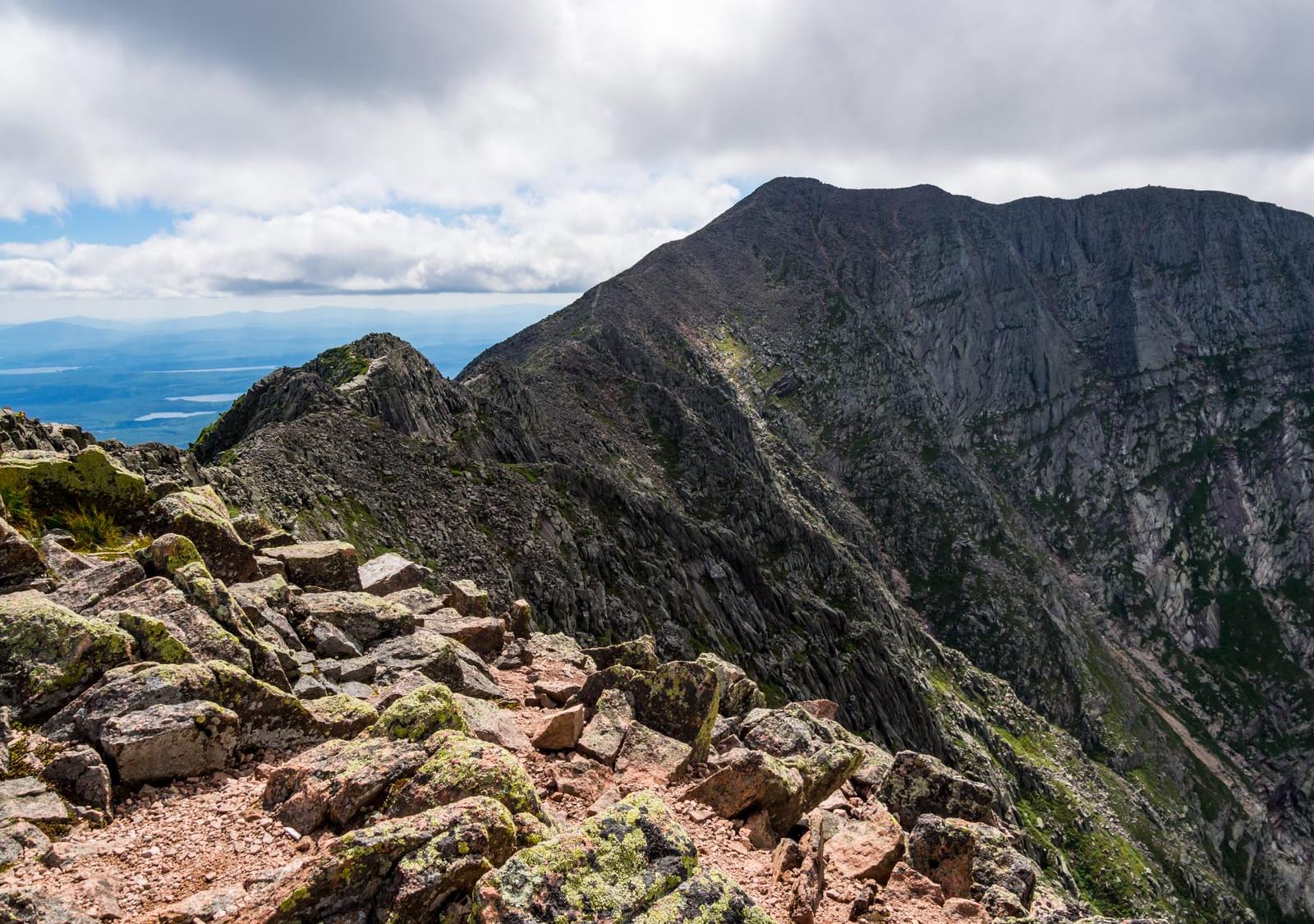
For a first Katahdin hike, the usual choices are the Hunt Trail or the Abol Trail from the west side of the mountain, or the Saddle Trail from Chimney Pond on the east side. The Hunt Trail is the Appalachian Trail's final climb (10.4 miles round trip), the Abol Trail is the shortest route from a road (8.8 miles), and the Saddle Trail is the most gradual way up from the east. The Knife Edge is the famous one, and it's best saved for a clear, calm day.
Whichever trail you pick, plan on 8–12 hours and about 4,000 feet of climbing. Day hikers who aren't camping in the park also need a Katahdin Trailhead Pass, a parking reservation that goes on sale April 1. The park says spots fill fast in July, August and on most weekends.
- SummitBaxter Peak, 5,267 ft
- ShortestAbol Trail, 8.8 mi
- ClassicHunt Trail, 10.4 mi
- GainAbout 4,000 ft
- Time8–12 hours
- Parking pass$10 a vehicle (2026)
- SeasonMay 26 – Oct 13, 2026
What makes hiking Katahdin different?
Katahdin sits inside Baxter State Park, which runs on its own rules. Percival Baxter, a former Maine governor, bought the first parcel, including Katahdin, in 1930 and gave it to the state in 1931 on the condition that it be kept forever wild. The park still quotes his intent:
Available for those who love nature and are willing to walk and make an effort to get close to nature
Percival P. Baxter, as quoted by Baxter State Park
In practice that means no pets, no drones and no groups larger than 12, and every hiker must carry a working flashlight. Children under six aren't allowed above treeline without a special permit.
Baxter Peak is also where the 2,197.9-mile Appalachian Trail ends (the 2026 figure), so in late summer you'll share the top with thru-hikers finishing from Georgia. The park planned a new summit sign for 2026 that reads 5,268 feet, citing USGS and a University of Maine survey, while the 1932 plaque nearby says 5,267.
What is the best trail up Katahdin?
For most first-timers it's the Hunt or Abol Trail for a simple out-and-back, or the Saddle Trail to start from the east and see Chimney Pond. Figures below are one way, from Baxter State Park's trail descriptions.
- Hunt Trail (Appalachian Trail). 5.2 miles and 4,188 feet of gain from Katahdin Stream Campground. It passes Katahdin Stream Falls, climbs the boulders on Hunt Spur and crosses the Tableland, with 2.4 miles above treeline.
- Abol Trail. 3.4 miles to the Hunt Trail, then 1 mile on the Hunt Trail to the summit, for 4.4 miles and 3,982 feet. It's the shortest route from a road, moved off the Abol Slide onto the ridge to its west in 2015. Water is limited after the first mile.
- Saddle Trail via Chimney Pond. 3.3 miles and 1,425 feet on the Chimney Pond Trail from Roaring Brook, then 2.2 miles and 2,353 feet on the Saddle Trail. The park calls it the most gradual ascent; the hard part is a 0.2-mile slide of loose rock and gravel just below the Tableland.
- Cathedral Trail. 1.7 miles and 2,353 feet from Chimney Pond to the summit, over three steep rock buttresses with no water. Descending it isn't recommended, so the usual plan is up Cathedral, down Saddle (about 10.5 miles from Roaring Brook).
- Helon Taylor Trail and the Knife Edge. 3.2 miles and 3,413 feet to Pamola Peak, then 1.1 miles across the Knife Edge to Baxter Peak. Coming down the Saddle and Chimney Pond Trails makes a loop of about 10 miles from Roaring Brook.
Round trip, that's 10.4 miles on the Hunt Trail, 8.8 on the Abol Trail and 11 on the Saddle Trail, with about 3,800 feet of total gain on Saddle.
Is the Knife Edge safe for a first hike?
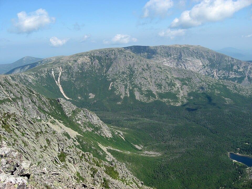
Only in good weather, and only if you're comfortable with steady exposure. The park describes the route as completely exposed and says several people have died or been seriously injured crossing it in bad weather or high winds.
It takes about 1 to 1½ hours one way, with no water. Once you've started, the park says not to try leaving the ridge, and it doesn't recommend crossing and coming back.
There's also a logistics trap. Cross from the Hunt or Abol side and you finish at Roaring Brook, an hour's drive from your car, and the park doesn't run a shuttle.
How long does it take to hike Katahdin?
The park puts the average round trip at 8–12 hours on any route. That covers roughly 9–11 miles of steep, rocky trail with about 4,000 feet of gain.
Plan at least as much time for the descent as the climb. The park says 80% of its search and rescues happen on the way down, and its turnaround rule is simple: if you aren't on top by mid-afternoon, you probably won't get down before dark. Park roads have a 20 mph limit, so leave time for the drive too.
Can you hike Katahdin without a permit?
Yes. Summer day hiking doesn't need a permit, but parking does. The three Katahdin trailheads (Katahdin Stream, Abol and Roaring Brook) are limited by vehicle, and a Katahdin Trailhead Pass, formerly called a Day Use Parking Reservation, holds your spot.
How the pass works in 2026 (check the park's site before you book, since details change):
- Passes go on sale April 1 for any day of the season, online, by phone at 207-723-5140 or in person.
- One pass covers one vehicle and everyone in it. The fee is $10, and passes are non-refundable.
- You can buy up to two per calendar month from June through October. They aren't required in May.
- The Togue Pond Gate opens at 6 a.m. Be in the pass holders' line by 7 a.m., or your spot is given to someone else.
No pass? Spaces still open, or forfeited at 7 a.m., go to a first-come line at the gate, and the park says there are usually some forfeits each day. Camping in the park the night before also covers trailhead access. Non-Maine vehicles pay a separate $20 entrance fee (2026). Passes are easiest to get on weekdays and after Labor Day, according to the Appalachian Trail Conservancy.
When does Katahdin open and close for the season?
Katahdin's trails open in late May or June, once the snow is gone, and close for the season in mid-October. In 2026 the Hunt and Abol Trails opened May 26, all park trails were open by June 10, and every Katahdin trail closed on October 13.
Trails can also close for a single day. Since 2025 the park has posted a daily above-treeline weather class at ranger stations, alongside the National Weather Service forecast from Caribou:
- Class 1 (green): excellent conditions
- Class 2 (yellow): fair, with possible rain, cool temperatures or moderate wind
- Class 3 (orange): poor; the park recommends staying below treeline or using extreme caution
- Class 4 (red): hazardous; the park strongly discourages going above treeline
- Black: hiking above treeline is closed for the day
Check the class that morning and keep a below-treeline backup in mind.
Can you hike Katahdin in October?
Early October, usually yes. Late October, usually no. The park strongly recommends that Appalachian Trail hikers summit before October 15, because the Katahdin trails close for a shoulder season that runs from October or November until December 1.
Days are short, and the park notes that snow can fall in any month. In 2026 most park campgrounds closed October 15 and the last ones closed October 22. Trailhead passes are still needed until October 15.
Can you hike Katahdin in winter?
Yes, but it's a mountaineering trip that needs paperwork. The winter season runs December 1 to March 31, and any trip above treeline, even a single day, requires a Winter Hiking/Camping Application received by the park at least 10 days ahead. It can't be approved over the phone.
Park roads aren't plowed, so south side trips start from a winter lot near Abol Bridge. The park's winter booklet says only very fit skiers or climbers in ideal conditions may manage Katahdin via the Abol Trail in a day, says that, depending on conditions, every slope and gully on the mountain is avalanche prone, and recommends an ice axe and crampons or microspikes.
How do you stay safe on Katahdin?
Start early, carry at least 2 quarts of water per person, treat any water you collect, and pack warm layers even in July. Sign the trailhead register so rangers know where to look.
Staying on the path also protects the alpine plants on the Tableland. Digging catholes is prohibited above treeline, so use the trailhead outhouses before you start or pack your waste out.
Are there other 4,000-footers in Baxter State Park?
Yes. Hamlin Peak on the Katahdin massif and North Brother are both on the New England 4,000 Footers list. North Brother is a good fallback when Katahdin passes are gone, since its Marston Trail trailhead is first come, first served.
Keeping track of Katahdin
Katahdin is one of the 50 State Highpoints, and the Yak page for Katahdin has its route, elevation and photos. Yak is a free app for iPhone and Android. You can check a 5-day summit forecast with temperature, wind and freezing level, plan a route on a topo map with an elevation profile, and log the climb afterward with the date, notes, photos and conditions.