
Hiking Mount Marcy: how long it takes and which trail to take
The standard route up New York's highest peak is 14.8 miles round trip, and most people do it in one long day. Here's how the trail breaks down, where to park and when to go
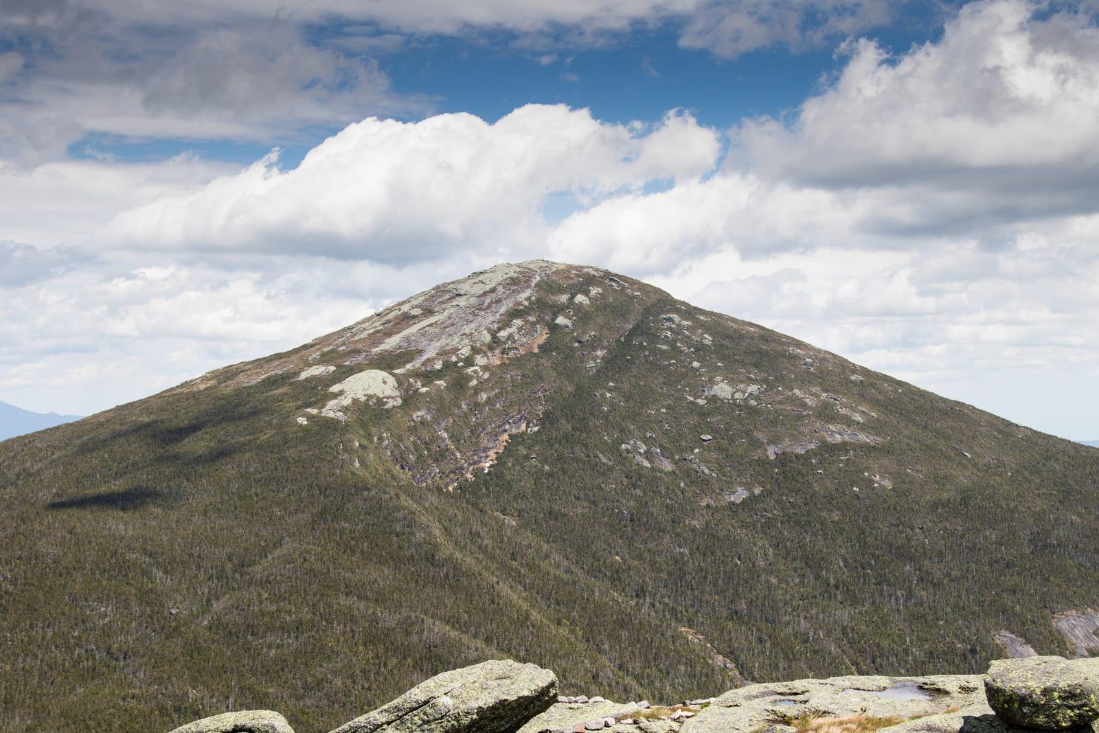
Most people hike Mount Marcy on the Van Hoevenberg Trail from the Adirondak Loj near Lake Placid. It's 7.4 miles each way, 14.8 miles round trip, and climbs a net 3,166 feet from the trailhead to the 5,344-foot summit, closer to 3,500 feet once you count the small dips along the way. Expect 7–11 hours on the trail. Most hikers do it in one long day, starting before sunrise.
The rest depends on the season and where you can park. The first recorded ascent was on August 5, 1837, by a state geological survey party led by Ebenezer Emmons, who named the peak after Governor William L. Marcy. They had no trail at all, just forest and thick scrub near the top.
- Summit5,344 ft
- TrailVan Hoevenberg Trail
- Round trip14.8 mi
- GainAbout 3,500 ft
- Time7–11 hours
- Parking$25, non-members (2026)
How long does it take to hike Mount Marcy?
Plan on 7–11 hours round trip on the Van Hoevenberg Trail. The distance is only part of it: much of the trail is rocky and rooty, there are brook crossings, and the last half mile is open rock, so the upper trail goes slowly, especially on the way down.
Can you hike Mount Marcy in a day?
Yes, and most people do. Start early enough to be back below treeline well before dark, and carry a headlamp anyway. The other option is to camp near Marcy Dam, 2.3 miles in, and climb the rest the next morning with a lighter pack.
Is Mount Marcy a hard hike?
Yes, mostly because of its length. Nothing on the standard route needs climbing skills, but it's a long, rough day with a steep, exposed finish.
Yak rates the route Class 2: you'll use your hands for balance on some of the summit slabs. If you haven't done a 10-mile hike with a couple thousand feet of climbing, build up to Marcy on shorter peaks first.
Which trail is best for Mount Marcy?
For most people, the Van Hoevenberg Trail. It's the shortest route and starts at a large staffed trailhead. It comes in three stages:
- Adirondak Loj to Marcy Dam (2.3 mi). Rolling, mostly gentle forest walking to the site of the old dam, which was badly damaged by Tropical Storm Irene in 2011. There are campsites and a trail register here.
- Marcy Dam to Indian Falls (to mile 4.4). The trail follows Phelps Brook and gets steeper and rockier. A short side path near Marcy Brook leads to the top of Indian Falls, with a view across to the MacIntyre Range.
- Indian Falls to the summit (to mile 7.4). The grade eases for a while and the summit cone comes into view. Treeline is at about mile 6.8, and from there it's a steep climb over open rock to the top. Follow the yellow paint blazes and cairns.
The DEC lists the Phelps Brook crossing above Marcy Dam and the crossing at Indian Falls among the High Peaks crossings that can rise quickly in rain.
How do you get to Mount Marcy, and where do you park?
The Van Hoevenberg Trail starts at the High Peaks Information Center, at the end of Adirondack Loj Road off Route 73 outside Lake Placid. The Adirondack Mountain Club (ADK) runs the lot. For 2026, ADK charges non-members $25 for a full day and $15 after 1 p.m.; members pay $10 and $6. No reservation is needed. In summer the lots often fill before 6 a.m. on weekends and before 9 a.m. on weekdays, and ADK doesn't let cars wait for a space. If the lot is full, check ADK's parking page for overflow options, which add walking each way.
That may change. An April 2026 consultant's report for the DEC suggested capping the Loj and South Meadows trailheads at about 400 visitors a day, possibly with permits. The DEC hasn't adopted it, so check before a 2027 trip.
The same trailhead is the start for Algonquin Peak, New York's second-highest mountain, whose trail splits off the Van Hoevenberg Trail about a mile in.
Are there other trails up Mount Marcy?
Yes: from Keene Valley, from Lake Colden by way of Avalanche Pass, and from Upper Works and Elk Lake to the south. All are longer.
From Keene Valley via Johns Brook
The Phelps Trail leaves the Garden trailhead in Keene Valley and follows Johns Brook to the summit, about 9 miles one way. ADK's Johns Brook Lodge, the state's only wilderness lodge, is 3.5 miles in, which makes this a natural two-day trip. The small Garden lot cost $10 a day in 2026, and the Town of Keene ran a $10 weekend shuttle from Marcy Field in summer and fall.
Starting through the Adirondack Mountain Reserve at St. Huberts, as on a Great Range traverse, needs a parking reservation from May 1 to October 31.
Via Avalanche Pass and Lake Colden
From Marcy Dam you can walk through Avalanche Pass to Lake Colden, then climb past Lake Tear of the Clouds, often called the highest source of the Hudson River, to the summit. Looping back down the Van Hoevenberg Trail makes a loop of roughly 17 to 20 miles, depending on which side of Lake Colden you take, either a very long day or an overnight.
Mudslides off Mount Colden closed Avalanche Pass in July 2025. The DEC reopened it on August 26, 2026, and says repair work will continue through 2027. As of November 2026, the Lake Arnold Trail is open but floods at the Opalescent River crossing, sometimes knee-deep or more.
When is the best time to hike Mount Marcy?
Summer and early fall, once mud season is over. That usually means from mid-June into October.
- Spring (mud season). From late March into mid-June, the DEC asks hikers to stay off trails above 2,500 feet until they dry. That covers almost all of the Marcy trail. Wet soils erode fast, and lingering ice makes slick "monorails" down the trail.
- Summer. The most reliable trail conditions, and the busiest parking lot. Summit stewards are on top most days.
- Fall. Cooler, with weekend crowds during foliage. By November the DEC reports ice at higher elevations and says traction devices and warm layers are needed.
For current trail conditions, the DEC posts weekly updates on its Adirondack backcountry information page, and the High Peaks Information Center staff know what the trail was like that week.
Can you hike Mount Marcy in the winter?
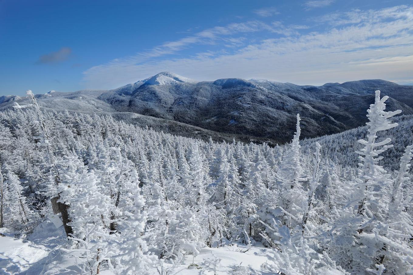
Yes, but it's a different trip. High Peaks rules require snowshoes or skis once snow is more than 8 inches deep, and you'll want crampons or other traction for the icy summit cone.
The DEC notes that temperatures up high can run 20–25 degrees colder than at the trailhead, before wind chill. Days are short and the summit takes the full wind. Bring extra non-cotton layers, goggles, a face mask, a headlamp with spare batteries and enough to get through a night out. Turning around at treeline is always an option.
Can you camp on Mount Marcy?
Not on the summit. You can camp lower down, under the Eastern High Peaks Wilderness rules:
- Elevation limits. No camping above 4,000 feet. Between 3,500 and 4,000 feet, you can only camp at a designated site.
- Bear canisters. Required for overnight campers in the Eastern High Peaks from April 1 to November 30. Hangs and soft bags don't count.
- No campfires anywhere in the Eastern Zone.
- Group size. At most 15 people on a day hike and 8 overnight.
Dogs must be leashed throughout the Eastern Zone.
What's on the summit of Mount Marcy?
Open bedrock, wide views, and some of the rarest plants in New York. The alpine zone covers only about 173 acres across 21 of the state's highest summits, and Marcy has one of the largest patches of it.
Summit stewards from ADK and the DEC have worked on Marcy since 1990. From late May to Indigenous Peoples' Day in October, they ask hikers to do the "rock walk": stay on bare rock and the marked path, and step around the small patches of soil and plants. As ADK puts it, these plants survive hurricane-force winds and short growing seasons but not human footsteps.
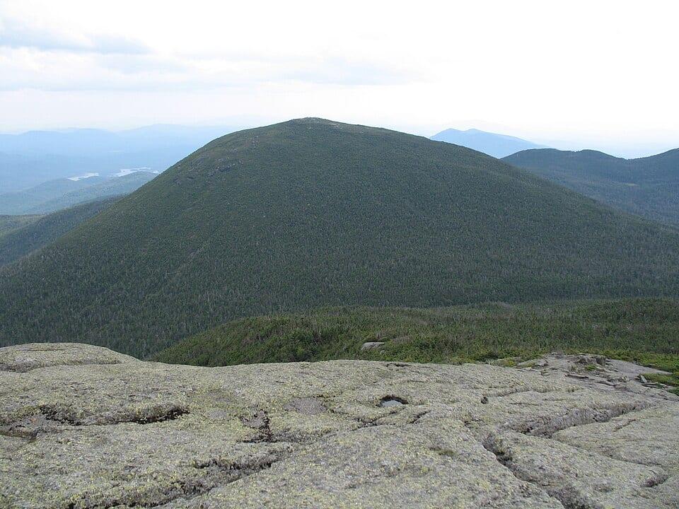
Looking south from the summit, the big rounded peak just across the valley is Mount Skylight, and Mount Haystack sits to the southeast. Both are common add-ons for a longer day.
Is Mount Marcy part of the 46 High Peaks?
Yes. Marcy is number one on the Adirondack 46ers list, the 46 peaks originally measured at 4,000 feet or higher. To register as a 46er you have to climb and descend all of them.
It's also New York's entry in the 50 State Highpoints, so it counts toward both lists in one day.
Can you drive up Mount Marcy?
No. There's no road anywhere near the summit, and the shortest way up is the 7.4-mile Van Hoevenberg Trail. The one High Peak with a road to the top is Whiteface Mountain, on the Veterans Memorial Highway, and driving it generally isn't accepted for 46er membership.
Keeping track of the 46
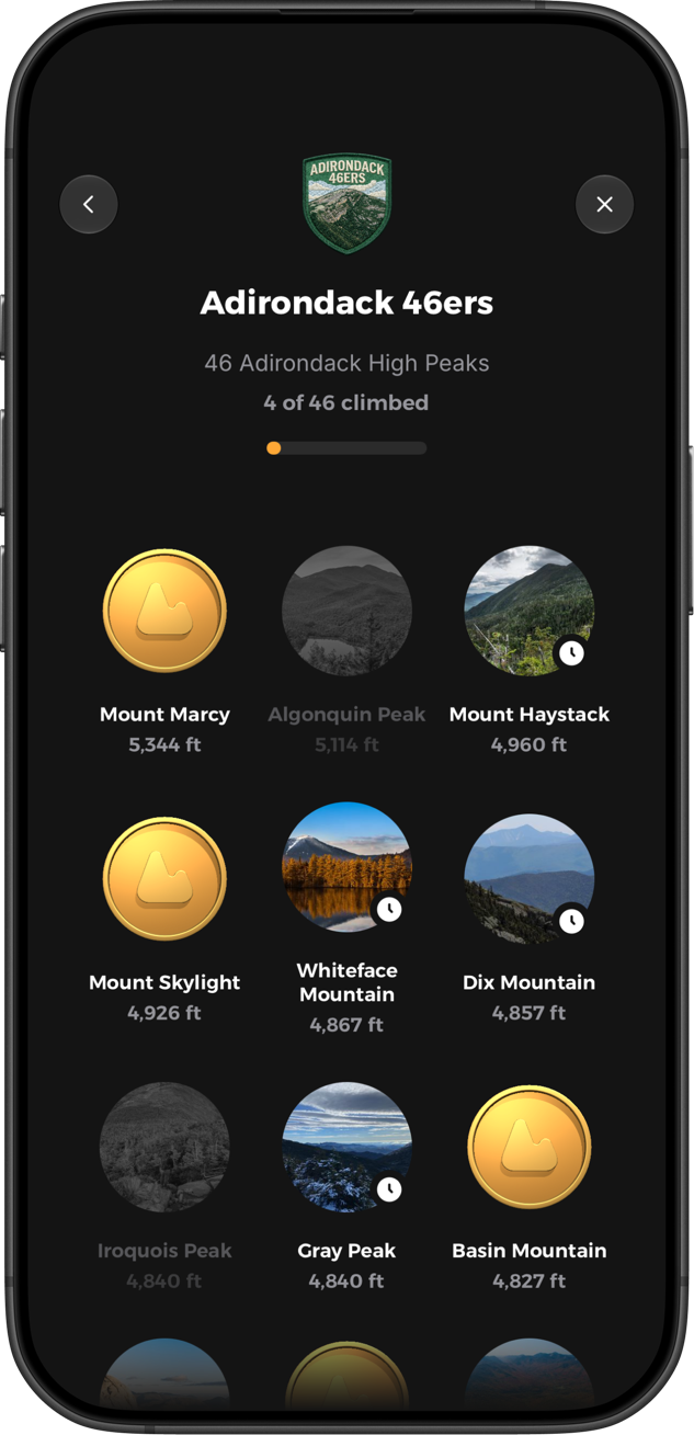
We built Yak for goals like this one, the kind that take a few seasons. In the free app for iPhone and Android, the Adirondack 46ers quest shows which peaks you've climbed and which are left. You can log each climb with notes, photos and conditions, and check a 5-day summit forecast with wind and freezing level before you go.
Rules and fees here are for 2026 and change from year to year, so check the ADK and DEC pages before you go.


