
The best apps for tracking the Colorado 14ers
Which app to use for checking off the peaks, finding the trail and watching the weather above treeline, and where each one falls short
Most Colorado hikers end up with two apps: one that keeps track of which 14ers they've climbed, and one that shows where they are on the trail. For the first job, 14ers.com is the default, with route descriptions, condition reports and a free checklist. For the second job, the big names are AllTrails, Gaia GPS, CalTopo and onX Backcountry, and all of them want a paid plan for full offline maps.
Very few apps do both jobs well, so it helps to know which one you're picking each app for.
What should a 14er tracker actually do?
A good 14er tracker holds the right list, marks each peak done or not done, and keeps the date and a few notes for every climb. The better ones also help with the next peak: conditions, weather and a route.
Here's what matters, roughly in order:
- The list you're following. The count changes depending on who you ask (more on that below), and an app that quietly uses a different list will throw off your total.
- Done, not done, and when. A checkmark is the minimum. A date makes the record useful years later, especially if you ever submit a completion form.
- Notes and conditions. Snow on the trail in June, a loose gully, the trailhead lot full at 5 a.m. These are what you'll wish you'd written down.
- Weather above treeline. Every 14er summit sits well above treeline, and the forecast for the town at the trailhead tells you little about wind and freezing level on the summit.
- A copy you control. Finishing the list can take a decade. It's worth knowing your record isn't stuck in one app.
How many 14ers are in Colorado?
Colorado has 58 named peaks above 14,000 feet and 53 that are "ranked," meaning they rise at least 300 feet above the saddle that connects them to a higher neighbor. The Colorado Mountain Club, which has recorded finishers for more than a century, recognizes a third number: 54.
The CMC's 54 are the 52 named, ranked peaks plus North Maroon Peak and El Diente Peak, included for their history. It leaves out Challenger Point, which it treats as a subsummit of Kit Carson Peak, and it accepts finishers who followed a longer list as long as their 54 are in it. The CMC's own finisher list starts with Carl Blaurock and Bill Ervin, who completed the peaks in 1923.
Apps don't all use the same count, so check which list yours follows. If you plan to register with the CMC, make sure your tracker includes their 54, whatever number it shows on the progress bar.
- Named 14ers58
- Ranked 14ers53
- CMC list54
- HighestMount Elbert, 14,440 ft
- First finish1923
Is there a 14ers.com app?
Yes. 14ers.com has a free official app for iPhone and Android with its route descriptions, route maps and photos, trailhead information and user-submitted peak condition reports, and it can record tracks and waypoints and export them as GPX or KML. Its store listings describe a guidebook you carry on the trail, not a list tracker.
The checklist lives on 14ers.com itself. A free account lets you check off each 14er or 13er, mark winter ascents, ski or snowboard descents, repeats and solo climbs, view your checklist as a list or on a map, and compare it with a partner's. Its checklist help page also spells out the conditions that calendar winter finishers have followed. The iPhone app alone has about 1,400 ratings, which gives a sense of how many Colorado hikers already use it.
For most people working on the 14ers, this is the place to start. The route descriptions are the most detailed you'll find, and the condition reports are the quickest way to learn whether a trail still has snow.
Which navigation app is best for 14ers?
Any of the four big ones will get you up a standard route, as long as you download the map before you lose signal, which happens on a lot of 14ers. All of them record your hike and offer offline maps, and all of them put offline maps in a paid plan (onX's free version saves just one offline map at a time). None of them is built to count your 14ers.
- AllTrails has a huge trail database (more than 500,000 trails) and recent reviews from other hikers, which helps on popular routes like Bierstadt or Quandary.
- Gaia GPS offers many map layers, such as topo, satellite and Forest Service maps, and is a favorite for off-trail and backpacking routes.
- CalTopo is the strongest for planning, especially on a computer, with tools like slope-angle shading for snow season. Its Mobile plan, which covers offline maps, is $20 a year as of November 2026 (check CalTopo for current pricing).
- onX Backcountry shows trails and public land, and its Elite plan adds private land boundaries, which matters for the few 14ers that cross private land.
For routes where a dead phone would be a real problem, carry a paper map too.
Which 14er weather forecast should you check?
Use a forecast for the summit, not the trailhead town, and look at wind and freezing level along with the temperature. The free National Weather Service point forecast at weather.gov lets you click right on a peak, and it's the source many apps start from. 14ers.com also links to peak forecasts from its weather menu.
Whatever you use, the pattern on summer 14ers is the same. The NWS office in Boulder notes that thunderstorms typically develop in Colorado's mountains after 11 a.m., and the Forest Service advises descending to treeline by noon.
Where Yak fits
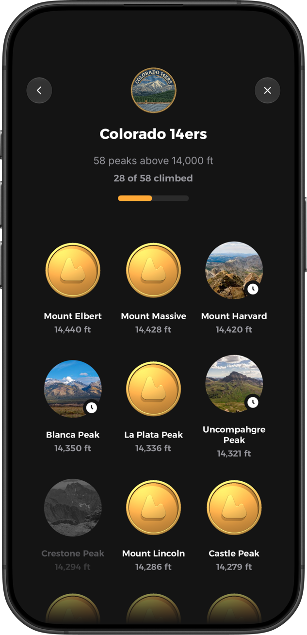
Yak is a free tracker for iPhone and Android built around lists, which we call quests. The Colorado 14ers quest uses all 58 peaks. You can record a climb with GPS or log it with a date, notes, photos and conditions, and each peak has a route map and a 5-day forecast. It's most useful if you're working on more than one list, since the Adirondack 46ers, the NH 48 and the state highpoints live in the same app.
It isn't a guidebook, and its community is much smaller than 14ers.com's, so you'll still want 14ers.com for detailed route descriptions and the latest condition reports.
Is a printable 14er checklist still worth keeping?
A paper or spreadsheet 14er checklist is a fine backup and costs nothing. It won't show the weather, but it will outlast any app.
The simplest version is a spreadsheet with the peak, the date, the route and who you went with. Update it whenever you log a climb in an app. If you ever fill out a CMC completion form, that list is what you'll copy from.
Whichever way you track them, the popular routes see a lot of boots. Stay on the established trail, pack out everything, and follow the seven Leave No Trace principles.


